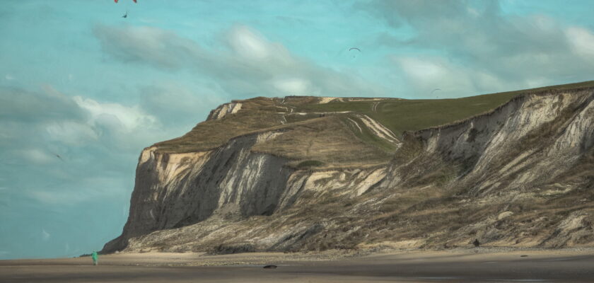
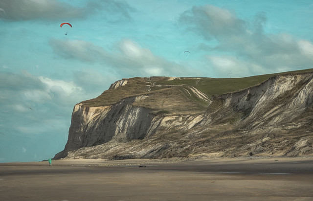
Cap Blanc-Nez (literally “Cape White Nose” in English; from Dutch Blankenesse, white headland) is a cape on the Côte d’Opale, in the Pas-de-Calais département, in northern France, culminating at 134 m. The cliffs of chalk are very similar to the white cliffs of Dover at the other side of the Channel in England. Cap Blanc-Nez does not protrude into the sea like a typical cape, but is a high point where a chalk ridge has been truncated by the sea, forming a cliff that is topped by the obelisk of the Dover Patrol Monument, commemorating the Dover Patrol which kept the Channel free from U-boats during World War I.
Cap Blanc-Nez was a vital measuring point for the eighteenth-century trigonometric survey linking the Paris Observatory with the Royal Greenwich Observatory. Sightings were made across the English Channel to Dover Castle and Fairlight Windmill on the South Downs. This Anglo-French Survey was led in England by General William Roy.
Some miles away to the southwest of Cap Blanc-Nez is the Cap Gris-Nez.
Cap Blanc-Nez (Nederlands: Kaap Blankenes; verouderd: Blankenesse, “witte nes”; een nes is een landtong) is een kaap aan het Kanaal bij de Franse gemeente Escalles in het departement Pas-de-Calais. Haar top ligt 134 m boven de zeespiegel.
Cap Blanc-Nez ligt 16 km ten noordoosten van Cap Gris-Nez. De kaap is te voet en per auto te bereiken. Er is een wandelpad van de top van de kaap tot aan het strand.
Plaatsnamen in deze streek verwijzen vaak naar het Middelnederlands. De verfransing gebeurde eerst tussen de 15de en de 17de eeuw. Blackenest is een benaming van de kaap die in geschriften uit de 16de eeuw wordt teruggevonden waarbij black verwijst naar het oudnederlandse woord blanka wat zoveel als helder of blank betekent. Nest verwijst naar nessa wat vooruitstekend stuk land in water betekent.
Cales Cliff is een andere benaming van de kaap die stamt uit de tijd toen het gebied nog aan de Engelsen toebehoorde.
Comments